| "i'r mynydd a'r mannau anghysbell" Thomas Richards, Y Wern 1948 | llanfrothenacroesor.org |
Welcome to Llanfrothen website
Here you will find information about the area and about the work of the community council as well as maps of local walks.
This website was set up by Llanfrothen Community Council. Contact us if you wish to contribute to the website.
Llanfrothen extends from the banks of the Glaslyn river across the Morfa Gwyllt marshland and upwards over the hills to the east, reaching the steep slopes and ridges of Cnicht and the Moelwynion.
South of the area there is a rocky ridge which runs eastwards. In the north-east and north are Moelwyn Bach, Moelwyn Mawr, Cnicht and Yr Wyddfa. Then, westwards towards the sea and Tremadog Bay are Moel Hebog, Moel Ddu and Moel y Gest.
Llanfrothen is named after Saint Brothen who established a church here in the sixth or seventh century.
There are three villages in Llanfrothen. They are Garreg, Croesor and Rhyd. Click here to see a map of the area.
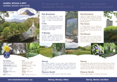
Walk 1: GARREG, MOSAIC AND MORE...
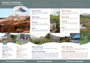
Walk 2: OLD PARISH OF LLANFROTHEN...
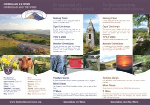
Walk 3: GWENLLIAN AND THE WERN...
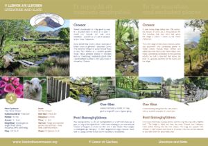
Walk 4: LITERATURE AND SLATE....
